<--- Back to Details
First PageDocument Content
Canada Centre for Remote Sensing / Natural Resources Canada / Geography / Earth sciences / Cartography / CCRS / RADARSAT / Satellite imagery / PCI Geomatica / Computer vision / Remote sensing / Earth
Date: 2011-10-15 08:48:32
Canada Centre for Remote Sensing
Natural Resources Canada
Geography
Earth sciences
Cartography
CCRS
RADARSAT
Satellite imagery
PCI Geomatica
Computer vision
Remote sensing
Earth

Preprint/Prétirage From Surfer to Scientist: Designing a Canadian Remote Sensing Service for the Internet Audience Langham, Christine W., Canada Centre for Remote Sensing, 588 Booth St., Ottawa, Ontario, Canada, K1A 0Y
Add to Reading List

Source URL: ftp2.cits.rncan.gc.ca

Download Document from Source Website

File Size: 182,13 KB

Share Document on Facebook

Similar Documents

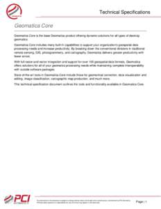
Technical Specifications Technical Specifications  Geomatica Core

Technical Specifications Technical Specifications Geomatica Core

DocID: 1r7cF - View Document

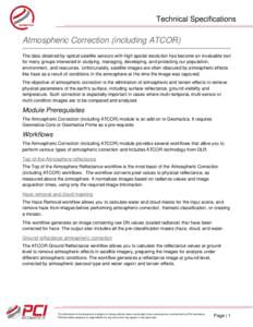
Technical Specifications  Atmospheric Correction (including ATCOR) The data obtained by optical satellite sensors with high spatial resolution has become an invaluable tool for many groups interested in studying, managin

Technical Specifications Atmospheric Correction (including ATCOR) The data obtained by optical satellite sensors with high spatial resolution has become an invaluable tool for many groups interested in studying, managin

DocID: 1qM3s - View Document

Geomatica 2016 System Specifications  Operating Systems The following operating systems are supported: Operating System Type

Geomatica 2016 System Specifications Operating Systems The following operating systems are supported: Operating System Type

DocID: 1qgOL - View Document

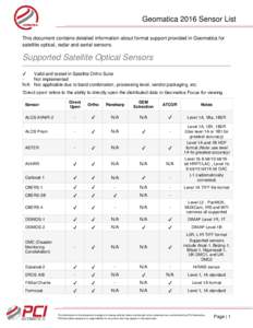
Geomatica 2016 Sensor List This document contains detailed information about format support provided in Geomatica for satellite optical, radar and aerial sensors. Supported Satellite Optical Sensors ✔

Geomatica 2016 Sensor List This document contains detailed information about format support provided in Geomatica for satellite optical, radar and aerial sensors. Supported Satellite Optical Sensors ✔

DocID: 1p35z - View Document

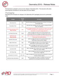
Geomatica 2016 – Release Notes PCI Geomatics is pleased to announce the release of GeomaticaThis document will outline some important information for all users about this new release. Packaging Geomatica 2016 in

Geomatica 2016 – Release Notes PCI Geomatics is pleased to announce the release of GeomaticaThis document will outline some important information for all users about this new release. Packaging Geomatica 2016 in

DocID: 1oCpA - View Document