<--- Back to Details
First PageDocument Content
Geographic information systems / World Wide Web / Air pollution / Air quality / Atmosphere / Earth / AirNow / Web Coverage Service / Application programming interface / Open Geospatial Consortium / Computing / Technology
Date: 2014-02-18 10:19:01
Geographic information systems
World Wide Web
Air pollution
Air quality
Atmosphere
Earth
AirNow
Web Coverage Service
Application programming interface
Open Geospatial Consortium
Computing
Technology

AirNow Interoperability Update Steven Ludewig1, Phil Dickerson2, John White2, Alan Healy1, Jonathan West1, Leslie Prince1 1Sonoma
Add to Reading List

Source URL: wiki.esipfed.org

Download Document from Source Website

File Size: 1,44 MB

Share Document on Facebook

Similar Documents

Infraestructura de Datos Espaciales Española GTIDEE CONSEJO SUPERIOR GEOGRÁFICO  Web Coverage Service (WCS) Versión 2.0

Infraestructura de Datos Espaciales Española GTIDEE CONSEJO SUPERIOR GEOGRÁFICO Web Coverage Service (WCS) Versión 2.0

DocID: 1rUcp - View Document

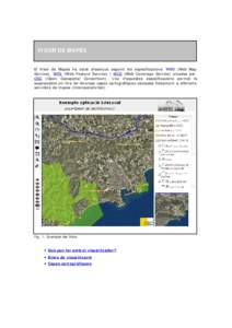
V  VISOR DE MAPES El Visor de Mapes ha estat dissenyat seguint les especificacions WMS (Web Map Service), WFS (Web Feature Service) i WCS (Web Coverage Service) creades per

V VISOR DE MAPES El Visor de Mapes ha estat dissenyat seguint les especificacions WMS (Web Map Service), WFS (Web Feature Service) i WCS (Web Coverage Service) creades per

DocID: 1rTK1 - View Document

THREDDS Explorer Access and visualization of Meteo-Oceanographic dynamic data with QGIS Harold Hormaechea Mauri Benedito-Bordonau

THREDDS Explorer Access and visualization of Meteo-Oceanographic dynamic data with QGIS Harold Hormaechea Mauri Benedito-Bordonau

DocID: 1rtgO - View Document

A demonstration of how simple the Web Feature service can be set up: The Croatian Experience Željko Hedimovid  ______________________________________________________________________________

A demonstration of how simple the Web Feature service can be set up: The Croatian Experience Željko Hedimovid ______________________________________________________________________________

DocID: 1rdtH - View Document

LiDAR User Data Needs Survey Results June 2012 Introduction The Minnesota Geospatial Information Office (MnGeo) is working with the Minnesota Department of Natural Resources (DNR) to develop a data distribution mechanism

LiDAR User Data Needs Survey Results June 2012 Introduction The Minnesota Geospatial Information Office (MnGeo) is working with the Minnesota Department of Natural Resources (DNR) to develop a data distribution mechanism

DocID: 1qX1A - View Document