Back to Results
First PageMeta Content
Planetary science / Japanese space program / Topography / Geomorphology / Advanced Land Observation Satellite / Digital elevation model / Alos / Topographic map / Japan Aerospace Exploration Agency / Spaceflight / Cartography / Earth


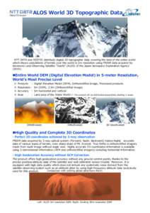
ALOS World 3D Topographic Data NTT DATA and RESTEC distribute digital 3D topographic data covering the land of the entire world which shows undulations of terrain over the world in 5m resolution using PRISM data acquire
Add to Reading List

Document Date: 2014-08-03 22:47:59


Open Document

File Size: 2,83 MB

Share Result on Facebook

Company

NTT DATA / RESTEC / Advanced Land Observing Satellite / /

Country

Us / /

Event

M&A / Natural Disaster / Environmental Issue / /

IndustryTerm

digital 3D topographic data / data distribution site / satellite observing system / /

NaturalFeature

Mt. Everest / Everest / /

Organization

Japan Aerospace Exploration Agency / /

Technology

remote sensing / /

URL

http /

SocialTag