<--- Back to Details
First PageDocument Content
Technology / Very Long Baseline Interferometry / Universal Time / Earth Orientation Parameters / Atomic clock / Satellite laser ranging / Radio astronomy / International Earth Rotation and Reference Systems Service / International Terrestrial Reference System / Geodesy / Measurement / Cartography
Date: 2013-11-21 20:58:03
Technology
Very Long Baseline Interferometry
Universal Time
Earth Orientation Parameters
Atomic clock
Satellite laser ranging
Radio astronomy
International Earth Rotation and Reference Systems Service
International Terrestrial Reference System
Geodesy
Measurement
Cartography

4-4 Role of VLBI Technology in the Space-Time Standards KOYAMA Yasuhiro In the VLBI observations, signals from Quasars which are realizing the current Celestial Reference Frame are directly used, and therefore all of the
Add to Reading List

Source URL: www.nict.go.jp

Download Document from Source Website

File Size: 633,32 KB

Share Document on Facebook

Similar Documents

Project for the Strengthening of Spatial Data Infrastructure in Member States and Territories of the Association of Caribbean States Geodesy Course Report One of the important phases of the project is to improve the capa

Project for the Strengthening of Spatial Data Infrastructure in Member States and Territories of the Association of Caribbean States Geodesy Course Report One of the important phases of the project is to improve the capa

DocID: 1rcSZ - View Document

Microsoft WordAFREF - Report_Final.doc

Microsoft WordAFREF - Report_Final.doc

DocID: 1qXNU - View Document

Geodesy / Measurement / Geomatics / Geophysics / Regional Reference Frame Sub-Commission for Europe / Geodetic datum / Geodetic control network / Earth ellipsoid / European Terrestrial Reference System / Global Positioning System / Benchmark / International Terrestrial Reference System

DECISION No. 669, datedON APPROVING OF THE RULES FOR DEFINING, CREATION AND REALIZATION OF THE ALBANIAN GEODETIC REFERENCE FRAME (KRGJSHAS METADATA Based on the Article 100 of the Constitution and on the

DocID: 1qw1w - View Document

Modernization of the PHILIPPINE GEODETIC REFERENCE SYSTEM  STRATEGIC PLAN

Modernization of the PHILIPPINE GEODETIC REFERENCE SYSTEM STRATEGIC PLAN

DocID: 1q10O - View Document

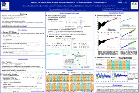
G53BKALREF – A Kalman Filter Approach to the International Terrestrial Reference Frame Realization! !  X. Frank Wu1, Claudio Abbondanza1, Zuheir Altamimi2, T. Mike Chin1, Xavier Collilieux2, Richard Gross1, Mich

G53BKALREF – A Kalman Filter Approach to the International Terrestrial Reference Frame Realization! ! X. Frank Wu1, Claudio Abbondanza1, Zuheir Altamimi2, T. Mike Chin1, Xavier Collilieux2, Richard Gross1, Mich

DocID: 1p4Pg - View Document