<--- Back to Details
First PageDocument Content
Geology / Geodiversity / Stonehenge / West Berkshire / Sarsen / North Wessex Downs / Lambourn / Museum of Reading / Counties of England / Berkshire / Geography of England
Date: 2013-02-14 18:46:30
Geology
Geodiversity
Stonehenge
West Berkshire
Sarsen
North Wessex Downs
Lambourn
Museum of Reading
Counties of England
Berkshire
Geography of England

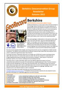
Berkshire Geoconservation Group Newsletter Autumn 2012

Add to Reading List

Source URL: www.berksgeoconservation.org.uk

Download Document from Source Website

File Size: 384,14 KB

Share Document on Facebook

Similar Documents

Involving People in Geodiversity

Involving People in Geodiversity

DocID: 1una6 - View Document

WINTER PROGRAMME SPEAKERSThursday 4th September 2014 “Geodiversity: Protecting and promoting Scotland’s geological heritage and iconic landscapes” by Simon Cuthbert We welcome the return of Dr Simon Cuthbe

WINTER PROGRAMME SPEAKERSThursday 4th September 2014 “Geodiversity: Protecting and promoting Scotland’s geological heritage and iconic landscapes” by Simon Cuthbert We welcome the return of Dr Simon Cuthbe

DocID: 1tS2m - View Document

SHROPSHIRE GEODIVERSITY ACTION PLAN SHROPSHIRE COUNTY COUNCIL. SHROPSHIRE GEOLOGICAL SOCIETY & SHROPSHIRE WILDLIFE TRUST

SHROPSHIRE GEODIVERSITY ACTION PLAN SHROPSHIRE COUNTY COUNCIL. SHROPSHIRE GEOLOGICAL SOCIETY & SHROPSHIRE WILDLIFE TRUST

DocID: 1sLLU - View Document

CALL FOR ABSTRACTS  SSS3.6/EOS7 Geoheritage and Geodiversity Matter: Themes, Links and Interactions convened by Benjamin van Wyk de Vries, Zbigniew Zwoliński, Paola Coratza, Marco Giardino,

CALL FOR ABSTRACTS SSS3.6/EOS7 Geoheritage and Geodiversity Matter: Themes, Links and Interactions convened by Benjamin van Wyk de Vries, Zbigniew Zwoliński, Paola Coratza, Marco Giardino,

DocID: 1swgd - View Document

European SCGIS Conference “Best practices: Application of GIS technologies for conservation of natural and cultural heritage sites” 2012  A GIS-BASED ASSESSMENT OF GEODIVERSITY IN THE MARAMURES

European SCGIS Conference “Best practices: Application of GIS technologies for conservation of natural and cultural heritage sites” 2012 A GIS-BASED ASSESSMENT OF GEODIVERSITY IN THE MARAMURES

DocID: 1srrC - View Document