<--- Back to Details
First PageDocument Content
Shire of Bruce Rock / Quairading /  Western Australia / Shire of Narembeen / Shire of Corrigin / Shire of Quairading / Shire of Merredin / Shire of Kellerberrin / Narembeen /  Western Australia / Protected areas of Western Australia / Wheatbelt / States and territories of Australia / Geography of Australia
Date: 2014-05-13 23:47:14
Shire of Bruce Rock
Quairading
Western Australia
Shire of Narembeen
Shire of Corrigin
Shire of Quairading
Shire of Merredin
Shire of Kellerberrin
Narembeen
Western Australia
Protected areas of Western Australia
Wheatbelt
States and territories of Australia
Geography of Australia

Shire of Bruce Rock Local Planning Strategy RO A D
Add to Reading List

Source URL: planning.wa.gov.au

Download Document from Source Website

File Size: 1,66 MB

Share Document on Facebook

Similar Documents

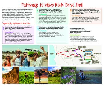
Pathways to Wave Rock Drive Trail Kulin is the perfect base to explore the Pathways to Wave Rock Drive Trail. The trail links the towns of Quairading, Bruce Rock, Narembeen, Hyden, Lake Grace, Kulin, Kondinin and Corrigi

Pathways to Wave Rock Drive Trail Kulin is the perfect base to explore the Pathways to Wave Rock Drive Trail. The trail links the towns of Quairading, Bruce Rock, Narembeen, Hyden, Lake Grace, Kulin, Kondinin and Corrigi

DocID: 1olwi - View Document

SHIRE OF BROOKTON ORDINARY COUNCIL MEETING AGENDA 20 February[removed]am

SHIRE OF BROOKTON ORDINARY COUNCIL MEETING AGENDA 20 February[removed]am

DocID: 11bR6 - View Document

Brookton Beverley Local Planning Strategy  KIMBERLEY Shire of Quairading

Brookton Beverley Local Planning Strategy KIMBERLEY Shire of Quairading

DocID: 115Pu - View Document

Case Studies  What Perennial Where? Ready Reckoner for perennial species developed for the[removed]Caring For

Case Studies What Perennial Where? Ready Reckoner for perennial species developed for the[removed]Caring For

DocID: 115Eg - View Document

Brookton and Beverley Local Planning Strategy Note: This Strategy map is a guide only. Exact locations and extent of land use categories are subject to investigations at the more detailed planning stages.

Brookton and Beverley Local Planning Strategy Note: This Strategy map is a guide only. Exact locations and extent of land use categories are subject to investigations at the more detailed planning stages.

DocID: 10UWT - View Document