<--- Back to Details
| First Page | Document Content | |
|---|---|---|
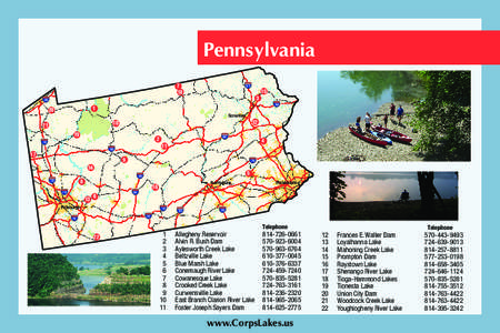
 Date: 2013-10-18 13:31:57Crooked Creek Conemaugh River Raystown Lake East Branch Clarion River Lake Curwensville Lake Geography of Pennsylvania Pennsylvania Mahoning Creek |
 | Herpetological Conservation and Biology 11(1):40–51. Submitted: 19 November 2014; Accepted: 11 February 2016; Published: 30 AprilGENETIC SIGNATURES FOLLOW DENDRITIC PATTERNS IN THE EASTERN HELLBENDER (CRYPTOBRANDocID: 1pz66 - View Document |
 | WATER RESOURCES DATA - PENNSYLVANIA, 1999 Water Resources Data Pennsylvania Water Year 1999 Volume 3. Ohio and St. Lawrence River BasinsDocID: 1ozTz - View Document |
 | FOR IMMEDIATE RELEASE TUESDAY, MARCH 23, 2015 FOR MORE INFORMATION, CONTACT JOHN McGARYDocID: 19SEn - View Document |
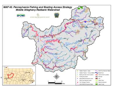
 | Microsoft Word - Chapter 4 with page numbers without Map 21 and HUC watershed maps and tables 5-55DocID: GjNC - View Document |
 | Microsoft Word - Chapter 4 with page numbers without Map 21 and HUC watershed maps and tables 5-55DocID: FmE6 - View Document |
