<--- Back to Details
First PageDocument Content
Transport / Cayuse people / Pendleton /  Oregon / British Columbia Highway 1 / Saskatchewan Highway 11 / Umatilla River / Frontage road / Oregon Route 11 / Geography of the United States / Oregon / Umatilla County /  Oregon / Pendleton-Hermiston micropolitan area
Date: 2006-11-10 20:05:15
Transport
Cayuse people
Pendleton
Oregon
British Columbia Highway 1
Saskatchewan Highway 11
Umatilla River
Frontage road
Oregon Route 11
Geography of the United States
Oregon
Umatilla County
Oregon
Pendleton-Hermiston micropolitan area

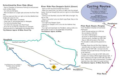
Echo/Umatilla River Ride (Blue) - Start at Chamber of Commerce Parking Lot and proceed north on Main Street. - Turn left onto SE Byers. - After one block turn a slight right and enter the River Parkway. Continue west and
Add to Reading List

Source URL: pendletononwheels.org

Download Document from Source Website

File Size: 47,13 KB

Share Document on Facebook

Similar Documents

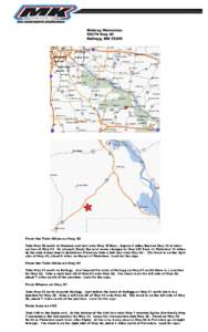
Midway MotocrossHwy 42 Kellogg, MNFrom the Twin Cities on Hwy 52 Take Hwy 52 south to Oronoco and turn onto Hwy 12 East. Approx 6 miles East on Hwy 12 to intersection of Hwy 63. Go straight (East) the road

Midway MotocrossHwy 42 Kellogg, MNFrom the Twin Cities on Hwy 52 Take Hwy 52 south to Oronoco and turn onto Hwy 12 East. Approx 6 miles East on Hwy 12 to intersection of Hwy 63. Go straight (East) the road

DocID: 1q2pt - View Document

Echo/Umatilla River Ride (Blue) - Start at Chamber of Commerce Parking Lot and proceed north on Main Street. - Turn left onto SE Byers. - After one block turn a slight right and enter the River Parkway. Continue west and

Echo/Umatilla River Ride (Blue) - Start at Chamber of Commerce Parking Lot and proceed north on Main Street. - Turn left onto SE Byers. - After one block turn a slight right and enter the River Parkway. Continue west and

DocID: 1gFJc - View Document

Commercial Vehicle Safety and Enforcement

Commercial Vehicle Safety and Enforcement

DocID: 1aj9F - View Document

www.tdec.net/swm/oil Fall Creek Falls F r o m N a s h v i l l e take I-40 East to Cookeville. Turn right onto 111 South (exitPark entrance is on the left on Highwaymiles).

www.tdec.net/swm/oil Fall Creek Falls F r o m N a s h v i l l e take I-40 East to Cookeville. Turn right onto 111 South (exitPark entrance is on the left on Highwaymiles).

DocID: 11Hzn - View Document

www.tdec.net/swm/oil Fall Creek Falls F r o m N a s h v i l l e take I-40 East to Cookeville. Turn right onto 111 South (exitPark entrance is on the left on Highwaymiles).

www.tdec.net/swm/oil Fall Creek Falls F r o m N a s h v i l l e take I-40 East to Cookeville. Turn right onto 111 South (exitPark entrance is on the left on Highwaymiles).

DocID: 10aYN - View Document