<--- Back to Details
First PageDocument Content
Earth / Geography / Fisheries science / Multibeam echosounder / Bathymetry / Seabed / Angle of incidence / Sonar / Remote sensing / Oceanography / Physical geography / Cartography
Date: 2013-04-11 20:59:13
Earth
Geography
Fisheries science
Multibeam echosounder
Bathymetry
Seabed
Angle of incidence
Sonar
Remote sensing
Oceanography
Physical geography
Cartography

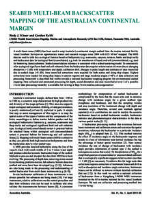
Seabed multi-beam backscatter mapping of the Australian continental margin Rudy J. Kloser and Gordon Keith CSIRO Wealth from Oceans Flagship, Marine and Atmospheric Research, GPO Box 1538, Hobart, Tasmania 7001, Austral
Add to Reading List

Source URL: www.acoustics.asn.au

Download Document from Source Website

File Size: 1,88 MB

Share Document on Facebook

Similar Documents

Ocean Exploration Accomplishments of Vessels Falkor and Okeanos Explorer in the Marianas Region: High Resolution Bathymetry Mapping and ROV Dives 139°E 140°E

Ocean Exploration Accomplishments of Vessels Falkor and Okeanos Explorer in the Marianas Region: High Resolution Bathymetry Mapping and ROV Dives 139°E 140°E

DocID: 1vcuH - View Document

Brazil Land Info offers a variety of digital topographic map & nautical chart data and satellite imagery products of Brazil including DEMs (Digital Elevation Models), bathymetry and vector layers such as contours, hydrol

Brazil Land Info offers a variety of digital topographic map & nautical chart data and satellite imagery products of Brazil including DEMs (Digital Elevation Models), bathymetry and vector layers such as contours, hydrol

DocID: 1syKW - View Document

Semiannual patterns of erosion and deposition in upper Monterey Canyon from serial multibeam bathymetry Douglas P. Smith† Genoveva Ruiz‡ Rikk Kvitek§ Pat J. Iampietro#

Semiannual patterns of erosion and deposition in upper Monterey Canyon from serial multibeam bathymetry Douglas P. Smith† Genoveva Ruiz‡ Rikk Kvitek§ Pat J. Iampietro#

DocID: 1suMt - View Document

Bulgaria Land Info offers a variety of digital topographic map & nautical chart data and satellite imagery products of Bulgaria including DEMs (Digital Elevation Models), bathymetry and vector layers such as contours, hy

Bulgaria Land Info offers a variety of digital topographic map & nautical chart data and satellite imagery products of Bulgaria including DEMs (Digital Elevation Models), bathymetry and vector layers such as contours, hy

DocID: 1st5s - View Document

Angola Land Info offers a variety of digital topographic map & nautical chart data and satellite imagery products of Angola including DEMs (Digital Elevation Models), bathymetry and vector layers such as contours, hydrol

Angola Land Info offers a variety of digital topographic map & nautical chart data and satellite imagery products of Angola including DEMs (Digital Elevation Models), bathymetry and vector layers such as contours, hydrol

DocID: 1sstT - View Document