<--- Back to Details
First PageDocument Content
Santa Cruz Mountains / Crystal Springs Dam / Sawyer Camp Trail / Crystal Springs Reservoir / San Andreas Lake / San Mateo Creek / San Francisco Public Utilities Commission / San Mateo County /  California / California Environmental Quality Act / Geography of California / Water in California / California
Date: 2014-04-29 17:07:09
Santa Cruz Mountains
Crystal Springs Dam
Sawyer Camp Trail
Crystal Springs Reservoir
San Andreas Lake
San Mateo Creek
San Francisco Public Utilities Commission
San Mateo County
California
California Environmental Quality Act
Geography of California
Water in California
California

COASTAL CONSERVANCY Staff Recommendation July 21, 2011 CRYSTAL SPRINGS REGIONAL TRAIL CONSTRUCTION Project No[removed]Project Manager: Ann Buell
Add to Reading List

Source URL: scc.ca.gov

Download Document from Source Website

File Size: 195,38 KB

Share Document on Facebook

Similar Documents

JOURNAL OF GEOPHYSICAL RESEARCH, VOL. 109, B08402, doi:2003JB002717, 2004  Late Pleistocene fault slip rate, earthquake recurrence, and recency of slip along the Pyramid Lake fault zone, northern Walker Lane, Uni

JOURNAL OF GEOPHYSICAL RESEARCH, VOL. 109, B08402, doi:2003JB002717, 2004 Late Pleistocene fault slip rate, earthquake recurrence, and recency of slip along the Pyramid Lake fault zone, northern Walker Lane, Uni

DocID: 1pMbh - View Document

Global Technology Associates, Inc.! 3505 Lake Lynda Drive, Suite 115! Orlando, FL[removed]USA! Tel: +[removed]Fax: +[removed]! Email: [removed] Web: www.gta.com

Global Technology Associates, Inc.! 3505 Lake Lynda Drive, Suite 115! Orlando, FL[removed]USA! Tel: +[removed]Fax: +[removed]! Email: [removed] Web: www.gta.com

DocID: Wphh - View Document

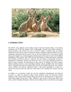
I. INTRODUCTION The CPNA, lying adjacent to the southwest edge of the San Joaquin Valley, is the largest remaining tract of the San Joaquin valley biogeographic province with limited evidence of human alteration. The 253

I. INTRODUCTION The CPNA, lying adjacent to the southwest edge of the San Joaquin Valley, is the largest remaining tract of the San Joaquin valley biogeographic province with limited evidence of human alteration. The 253

DocID: Mg7L - View Document

ICDP USA  1 von 10 http://www-icdp.icdp-online.org/front_content.php?idcat=1709&idart...

ICDP USA 1 von 10 http://www-icdp.icdp-online.org/front_content.php?idcat=1709&idart...

DocID: Gi4w - View Document

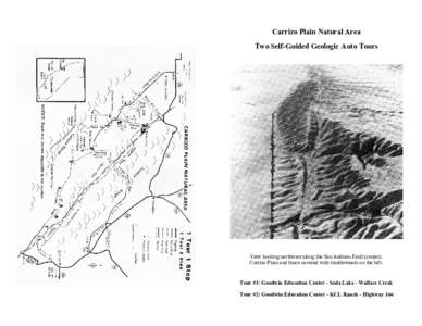
Carrizo Plain Natural Area Two Self-Guided Geologic Auto Tours View looking northwest along the San Andreas Fault (center). Carrizo Plain and fence covered with tumbleweeds on the left.

Carrizo Plain Natural Area Two Self-Guided Geologic Auto Tours View looking northwest along the San Andreas Fault (center). Carrizo Plain and fence covered with tumbleweeds on the left.

DocID: FHKV - View Document