<--- Back to Details
First PageDocument Content
Nautical chart / Air navigation / Celestial navigation / Dead reckoning / Navigator / Compass / Flight / Aeronautical chart / Map / Navigation / Transport / Aerospace engineering
Date: 2013-06-10 15:25:42
Nautical chart
Air navigation
Celestial navigation
Dead reckoning
Navigator
Compass
Flight
Aeronautical chart
Map
Navigation
Transport
Aerospace engineering

Navigation Lesson 7 - By Land, Sea, or Air.PDF
Add to Reading List

Source URL: www.ion.org

Download Document from Source Website

File Size: 455,02 KB

Share Document on Facebook

Similar Documents

DRAGON POINT NAVIGATION CHALLENGE (An Application of Traditional Dead Reckoning Navigation Skills) OBJECTIVE To navigate several prescribed legs of a Course as accurately as possible. The winner will be determined by the

DRAGON POINT NAVIGATION CHALLENGE (An Application of Traditional Dead Reckoning Navigation Skills) OBJECTIVE To navigate several prescribed legs of a Course as accurately as possible. The winner will be determined by the

DocID: 1vaT7 - View Document

Location Information Literacy What are the Solutions? (GPS, GIS, cell phones, dead reckoning, talking signs) (Education, awareness, reaching outside one’s comfort zone) By Michael May

DocID: 1tCK2 - View Document

The Practical Use of the Bemer Method for Exponentials Update Version: September 5, 2006 Ron Doerfler (http://www.myreckonings.com) In Chapter 4 of my book, Dead Reckoning: Calculating Without Instruments, a method is gi

The Practical Use of the Bemer Method for Exponentials Update Version: September 5, 2006 Ron Doerfler (http://www.myreckonings.com) In Chapter 4 of my book, Dead Reckoning: Calculating Without Instruments, a method is gi

DocID: 1rrb5 - View Document

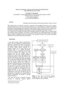
DIGITAL MAGNETIC COMPASS AND GYROSCOPE INTEGRATION FOR PEDESTRIAN NAVIGATION Q. Ladetto*, B. Merminod** Faculté ENAC - Institut du Développement Territorial, Geodetic Laboratory (TOPO) CH-1015 Lausanne, Switzerland. WW

DIGITAL MAGNETIC COMPASS AND GYROSCOPE INTEGRATION FOR PEDESTRIAN NAVIGATION Q. Ladetto*, B. Merminod** Faculté ENAC - Institut du Développement Territorial, Geodetic Laboratory (TOPO) CH-1015 Lausanne, Switzerland. WW

DocID: 1rq4G - View Document

Projet: Pedestrian Dead Reckoning for Android Navigation à l’estime pour piéton pour Android Thibaud Michel Université Joseph Fourier Laboratoire d’Informatique de Grenoble

Projet: Pedestrian Dead Reckoning for Android Navigation à l’estime pour piéton pour Android Thibaud Michel Université Joseph Fourier Laboratoire d’Informatique de Grenoble

DocID: 1rffN - View Document