<--- Back to Details
First PageDocument Content
St. Croix / Geography of Canada / International Joint Commission / Water / Chiputneticook Lakes / Calais /  Maine / Spednic Lake / Canada–United States border / New Brunswick / Saint Croix River
Date: 2015-01-06 16:44:17
St. Croix
Geography of Canada
International Joint Commission
Water
Chiputneticook Lakes
Calais
Maine
Spednic Lake
Canada–United States border
New Brunswick
Saint Croix River

Title 38: WATERS AND NAVIGATION Chapter 8: ST. CROIX INTERNATIONAL WATERWAY COMMISSION HEADING: PL 1987, c. 470, §2 (new) Table of Contents Section 991. FINDINGS AND PURPOSE..............................................
Add to Reading List

Source URL: legislature.maine.gov

Download Document from Source Website

File Size: 32,03 KB

Share Document on Facebook

Similar Documents

UNITED STATES DEPARTMENT OF COMMERCE NATIONAL OCEANIC & ATMOSPHERIC ADMINISTRATION NATIONAL OCEAN SERVICE NATIONAL GEODETIC SURVEY INTERNATIONAL EARTH ROTATION & REFERENCE SYSTEM SERVICES ST. CROIX, USVI LOCAL SITE SURVE

UNITED STATES DEPARTMENT OF COMMERCE NATIONAL OCEANIC & ATMOSPHERIC ADMINISTRATION NATIONAL OCEAN SERVICE NATIONAL GEODETIC SURVEY INTERNATIONAL EARTH ROTATION & REFERENCE SYSTEM SERVICES ST. CROIX, USVI LOCAL SITE SURVE

DocID: 1uPrt - View Document

VIRGIN ISLANDS PORT AUTHORITY ST. THOMAS ▪ ST. CROIX ▪ ST. JOHN UNITED STATES VIRGIN ISLANDS  For Immediate Release

VIRGIN ISLANDS PORT AUTHORITY ST. THOMAS ▪ ST. CROIX ▪ ST. JOHN UNITED STATES VIRGIN ISLANDS For Immediate Release

DocID: 1uFgu - View Document

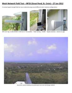
Mesh Network Field Test – NP2X (Great Pond, St. Croix) – 27 Jun 2012 A received signal strength field test was conducted using several different node / antenna configurations. WiFi-Link Yagi -16 dBi (P/NWLY)

Mesh Network Field Test – NP2X (Great Pond, St. Croix) – 27 Jun 2012 A received signal strength field test was conducted using several different node / antenna configurations. WiFi-Link Yagi -16 dBi (P/NWLY)

DocID: 1uAkB - View Document

Trego Lake Trail  St. Croix National Scenic Riverway Contact the National Park Service Namekagon River Visitor Center Highway 63, half mile east of Highway 53

Trego Lake Trail St. Croix National Scenic Riverway Contact the National Park Service Namekagon River Visitor Center Highway 63, half mile east of Highway 53

DocID: 1uoy6 - View Document

WORK PLAN for the Benthic Habitat Mapping of St. Croix, USVI, for the Department of Interior - National Park Service

WORK PLAN for the Benthic Habitat Mapping of St. Croix, USVI, for the Department of Interior - National Park Service

DocID: 1u8pP - View Document