<--- Back to Details
First PageDocument Content
Montana / Geography of the United States / Western United States / Lewis and Clark National Forest / Little Belt Mountains / Stop Online Piracy Act / Beaverhead-Deerlodge National Forest
Date: 2016-04-19 13:47:20
Montana
Geography of the United States
Western United States
Lewis and Clark National Forest
Little Belt Mountains
Stop Online Piracy Act
Beaverhead-Deerlodge National Forest

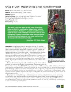
CASE STUDY: Upper Sheep Creek Farm Bill Project Forest: Helena and Lewis & Clark National Forest District: White Sulphur Springs Ranger District County: Meagher NEPA Tool Used: Farm Bill/Insect & Disease Categorical Excl
Add to Reading List

Source URL: dnrc.mt.gov

Download Document from Source Website

File Size: 1,14 MB

Share Document on Facebook

Similar Documents

CASE STUDY: Upper Sheep Creek Farm Bill Project Forest: Helena and Lewis & Clark National Forest District: White Sulphur Springs Ranger District County: Meagher NEPA Tool Used: Farm Bill/Insect & Disease Categorical Excl

CASE STUDY: Upper Sheep Creek Farm Bill Project Forest: Helena and Lewis & Clark National Forest District: White Sulphur Springs Ranger District County: Meagher NEPA Tool Used: Farm Bill/Insect & Disease Categorical Excl

DocID: 1rdzo - View Document

Geography of the United States / Idaho / Western United States / Wild and Scenic Rivers of the United States / Clearwater National Forest / Bitterroot Range / Salmon River / Salmon-Challis National Forest / Sawtooth National Forest / Lochsa River / Clearwater River / Hells Canyon

NAGT Pacific Northwest Section, 2016 Conference Hells Canyon to the Salmon River of No Return: the Mesozoic accretionary boundary of west-central Idaho June 21st-24th, 2016 Field Trip Leaders Keegan Schmidt, Lewis-Clark

DocID: 1qqiC - View Document

2011 Motor Vehicle Use Map for the Rocky Mountain Ranger District, Lewis and Clark National Forest

2011 Motor Vehicle Use Map for the Rocky Mountain Ranger District, Lewis and Clark National Forest

DocID: 1gSms - View Document

Motor Vehicle Use Map Lewis and Clark National Forest THE PURPOSE AND CONTENTS OF THIS MAP The designations shown on this motor vehicle use map (MVUM) were made by

Motor Vehicle Use Map Lewis and Clark National Forest THE PURPOSE AND CONTENTS OF THIS MAP The designations shown on this motor vehicle use map (MVUM) were made by

DocID: 1cmS6 - View Document

2011 MVUM for the Highwood Mountains, Lewis and Clark National Forest, Montana

2011 MVUM for the Highwood Mountains, Lewis and Clark National Forest, Montana

DocID: 1b0Ra - View Document