<--- Back to Details
First PageDocument Content
Geography of the United Kingdom / Great Britain Historical GIS / Historical geographic information system / Oracle Spatial / GeoTools / Visualization / Computing / Oracle Database / Software / Geographic information systems / Science
Date: 2008-05-14 03:47:32
Geography of the United Kingdom
Great Britain Historical GIS
Historical geographic information system
Oracle Spatial
GeoTools
Visualization
Computing
Oracle Database
Software
Geographic information systems
Science

Microsoft PowerPoint - American_Geographers_Boston_April_2008-1.ppt
Add to Reading List

Source URL: www.qviz.eu

Download Document from Source Website

File Size: 2,51 MB

Share Document on Facebook

Similar Documents

A new Vision for OSGeo Jody Garnett
 (Boundless)  Helena Mitasova


A new Vision for OSGeo Jody Garnett
 (Boundless) Helena Mitasova


DocID: 1oyMl - View Document

“Agile GIS”: Building applicationspecific spatial analytic software from freely available software tools Lance A. Waller, Andrew B. Barclay Department of Biostatistics Rollins School of Public Health

“Agile GIS”: Building applicationspecific spatial analytic software from freely available software tools Lance A. Waller, Andrew B. Barclay Department of Biostatistics Rollins School of Public Health

DocID: 1lw15 - View Document

Coastal Flood Hazards in the Great Lakes A Pilot Study for Erie County, PA Christina Lindemer Jeffery Gangai Taylor Asher

Coastal Flood Hazards in the Great Lakes A Pilot Study for Erie County, PA Christina Lindemer Jeffery Gangai Taylor Asher

DocID: 1bZXs - View Document

Using NOAA’s Digital Coast for Community Hazard Mitigation Planning in Monterey County, CA Virtual Coastal GeoTools June 20, 2013 Darrin Punchard, AICP, CFM

Using NOAA’s Digital Coast for Community Hazard Mitigation Planning in Monterey County, CA Virtual Coastal GeoTools June 20, 2013 Darrin Punchard, AICP, CFM

DocID: 1bFXW - View Document

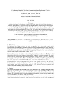
Exploring Digital Welfare data using GeoTools and Grids Hodkinson, S.N., Turner, A.G.D. School of Geography, University of Leeds June 20, 2014 Summary

Exploring Digital Welfare data using GeoTools and Grids Hodkinson, S.N., Turner, A.G.D. School of Geography, University of Leeds June 20, 2014 Summary

DocID: 18RiM - View Document