<--- Back to Details
| First Page | Document Content | |
|---|---|---|
 Date: 2013-03-10 05:00:00Geography of the United States Great Bay Intracoastal Waterway Oyster River Squamscott River National Estuarine Research Reserve Winnicut River Environmental indicator Lamprey River Stratham New Hampshire Estuary Oyster |
Add to Reading List |
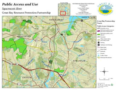 | Public Access and Use Location Map Squamscott RiverDocID: 1sarN - View Document |
 | Microsoft WordDRAFT FINAL WISE Project Plan.docxDocID: 1rhcK - View Document |
 | Microsoft Word_Final Integrated PlanDocID: 1reCT - View Document |
 | Microsoft Word_Final Integrated PlanDocID: 1ra6m - View Document |
 | Microsoft PowerPointPT Meeting_v12.final working.pptxDocID: 1r2pe - View Document |
 T Spotlight racking Great Bay’s Vital Signs