<--- Back to Details
First PageDocument Content
Upper Nile / Geography of Africa / Counties of South Sudan / Doleib Hill / Malakal / Maiwut / Melut / Shilluk people / Riek Machar / South Sudan / Greater Upper Nile / Sobat River
Date: 2014-10-16 08:09:32
Upper Nile
Geography of Africa
Counties of South Sudan
Doleib Hill
Malakal
Maiwut
Melut
Shilluk people
Riek Machar
South Sudan
Greater Upper Nile
Sobat River

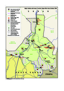
Major clashes and areas of control, Upper Nile state, October[removed]County under SPLA control, October[removed]U

Add to Reading List

Source URL: www.smallarmssurveysudan.org

Download Document from Source Website

File Size: 1,31 MB

Share Document on Facebook

Similar Documents

Tectonic Evolution Control on Hydrocarbon Accumulation in Fractured Basement: A Case Study from Melut Basin in South Sudan and Bongor Basin in Chad, #).

Tectonic Evolution Control on Hydrocarbon Accumulation in Fractured Basement: A Case Study from Melut Basin in South Sudan and Bongor Basin in Chad, #).

DocID: 1niPb - View Document

Indian Army’s Participation In UN Peacekeeping Missions Monthly Update February[removed]www.usiofindia.org/cunpk.htm

Indian Army’s Participation In UN Peacekeeping Missions Monthly Update February[removed]www.usiofindia.org/cunpk.htm

DocID: ZNEl - View Document

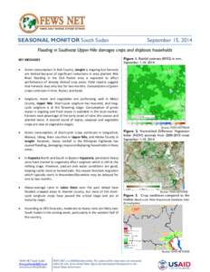
SEASONAL MONITOR South Sudan  September 15, 2014 Flooding in Southeast Upper Nile damages crops and displaces households Figure 1. Rainfall estimate (RFE2) in mm,

SEASONAL MONITOR South Sudan September 15, 2014 Flooding in Southeast Upper Nile damages crops and displaces households Figure 1. Rainfall estimate (RFE2) in mm,

DocID: Z8y8 - View Document

This map illustrates IDP settlements in Melut, Upper Nile State, South Sudan. Using highresolution imagery optical satellite imagery collected by the WorldView-3 satellite on 2 December 2014, UNOSAT located 3,587 IDP str

This map illustrates IDP settlements in Melut, Upper Nile State, South Sudan. Using highresolution imagery optical satellite imagery collected by the WorldView-3 satellite on 2 December 2014, UNOSAT located 3,587 IDP str

DocID: MgEJ - View Document

This map illustrates IDP settlements in Melut, Upper Nile State, South Sudan. Using highresolution imagery optical satellite imagery collected by the WorldView-3 satellite on 2 December 2014, UNOSAT located 3,587 IDP str

This map illustrates IDP settlements in Melut, Upper Nile State, South Sudan. Using highresolution imagery optical satellite imagery collected by the WorldView-3 satellite on 2 December 2014, UNOSAT located 3,587 IDP str

DocID: KoM1 - View Document