Imagery

Results: 3595


#Item
21COLLECTION DEVELOPMENT POLICY FOR THE NATIONAL GEOSPATIAL DIGITAL ARCHIVE: Node, Map and Imagery Laboratory (MIL), Davidson Library, University of California, Santa Barbara May 2007 I. Collection purpose and description

COLLECTION DEVELOPMENT POLICY FOR THE NATIONAL GEOSPATIAL DIGITAL ARCHIVE: Node, Map and Imagery Laboratory (MIL), Davidson Library, University of California, Santa Barbara May 2007 I. Collection purpose and description

Add to Reading List

Source URL: www.ngda.org

Language: English - Date: 2009-12-16 16:57:58
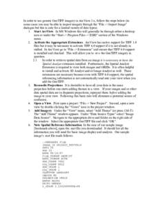
    22In order to use generic GeoTIFF imagery in ArcView 3.x, follow the steps below (in some cases you may be able to import imagery through the “File -> Import Image” dialogue but this is only for a limited variety of da

    In order to use generic GeoTIFF imagery in ArcView 3.x, follow the steps below (in some cases you may be able to import imagery through the “File -> Import Image” dialogue but this is only for a limited variety of da

    Add to Reading List

    Source URL: landcover.org

    Language: English - Date: 2011-04-12 16:17:03
      23DIGITAL FORENSIC RESEARCH CONFERENCE  Using JPEG Quantization Tables to Identify Imagery Processed by Software By

      DIGITAL FORENSIC RESEARCH CONFERENCE Using JPEG Quantization Tables to Identify Imagery Processed by Software By

      Add to Reading List

      Source URL: dfrws.org

      Language: English - Date: 2017-07-18 14:46:28
        24Example Search Report Lent, The Netherlands Paid Search Service Thank you for ordering a Paid Search of the catalogued aerial imagery at NCAP. Low-resolution imagery showing your stated Area of Interest (AOI) during you

        Example Search Report Lent, The Netherlands Paid Search Service Thank you for ordering a Paid Search of the catalogued aerial imagery at NCAP. Low-resolution imagery showing your stated Area of Interest (AOI) during you

        Add to Reading List

        Source URL: ncap.org.uk

        Language: English - Date: 2017-10-17 05:57:51
          25HIGH-RESOLUTION SOIL MOISTURE MAPPING USING OPERATIONAL OPTICAL SATELLITE IMAGERY Jan M.H. Hendrickx1, J. Bruce J. Harrison, Brian Borchers, and Graciela Rodríguez-Marín New Mexico Tech, Socorro, NMStacy Howingt

          HIGH-RESOLUTION SOIL MOISTURE MAPPING USING OPERATIONAL OPTICAL SATELLITE IMAGERY Jan M.H. Hendrickx1, J. Bruce J. Harrison, Brian Borchers, and Graciela Rodríguez-Marín New Mexico Tech, Socorro, NMStacy Howingt

          Add to Reading List

          Source URL: infohost.nmt.edu

          Language: English - Date: 2015-03-14 18:30:21
            26About the Satellite Imagery. The Satellites. Full details of the satellites can be found at the NOAA web site: http://www2.ncdc.noaa.gov/docs/podug/ The polar orbitting satellites tracked here at Wokingham are in sun-syn

            About the Satellite Imagery. The Satellites. Full details of the satellites can be found at the NOAA web site: http://www2.ncdc.noaa.gov/docs/podug/ The polar orbitting satellites tracked here at Wokingham are in sun-syn

            Add to Reading List

            Source URL: www.woksat.info

            Language: English - Date: 2009-08-09 18:11:28
              27NLS annual review imagery

              NLS annual review imagery

              Add to Reading List

              Source URL: www.nls.uk

              Language: English - Date: 2010-08-30 11:08:36
                282. Abstract Geospatial information has played an important role in the history of the United States. From the first colonial maps to the satellite imagery of the 21st century, cartographic information has helped define a

                2. Abstract Geospatial information has played an important role in the history of the United States. From the first colonial maps to the satellite imagery of the 21st century, cartographic information has helped define a

                Add to Reading List

                Source URL: www.ngda.org

                Language: English - Date: 2009-11-10 19:48:03
                  29Detecting & Modeling Change in Time-Varying Imagery Peggy Agouris Dept. of Spatial Information Engineering University of Maine

                  Detecting & Modeling Change in Time-Varying Imagery Peggy Agouris Dept. of Spatial Information Engineering University of Maine

                  Add to Reading List

                  Source URL: www.ncgia.ucsb.edu

                  Language: English - Date: 2015-10-21 13:20:42
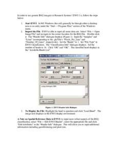
                    30In order to use generic BSQ imagery in Research Systems’ ENVI 3.x, follow the steps below: Start ENVI. In MS Windows this will generally be through either a desktop

                    In order to use generic BSQ imagery in Research Systems’ ENVI 3.x, follow the steps below: Start ENVI. In MS Windows this will generally be through either a desktop

                    Add to Reading List

                    Source URL: www.landcover.org

                    Language: English - Date: 2011-04-12 16:17:00