<--- Back to Details
First PageDocument Content
Spacecraft / Spaceflight / Exploration of the Moon / Japanese Lunar Exploration Program / SELENE / Remote sensing / Spectroscopy / Clementine / Infrared / Moon / Multispectral image / JAXA
Date: 2008-04-07 22:15:09
Spacecraft
Spaceflight
Exploration of the Moon
Japanese Lunar Exploration Program
SELENE
Remote sensing
Spectroscopy
Clementine
Infrared
Moon
Multispectral image
JAXA

Earth Planets Space, 60, 257–264, 2008 Performance and scientific objectives of the SELENE (KAGUYA) Multiband Imager Makiko Ohtake1 , Junichi Haruyama1 , Tsuneo Matsunaga2 , Yasuhiro Yokota1 , Tomokatsu Morota1 , Chik

Add to Reading List

Source URL: www.terrapub.co.jp

Download Document from Source Website

File Size: 1,44 MB

Share Document on Facebook

Similar Documents

Technical Specifications  Pan Sharpening The PANSHARP algorithm applies an automatic image fusion that increases the resolution of multispectral (color) image data by using a high-resolution panchromatic (black and white

Technical Specifications Pan Sharpening The PANSHARP algorithm applies an automatic image fusion that increases the resolution of multispectral (color) image data by using a high-resolution panchromatic (black and white

DocID: 1rEFf - View Document

Effects of LiDAR-Quickbird fusion on object-oriented classification of mountain resort development Natalie Campos Rick Lawrence

Effects of LiDAR-Quickbird fusion on object-oriented classification of mountain resort development Natalie Campos Rick Lawrence

DocID: 1rqgG - View Document

IEEE JOURNAL OF SELECTED TOPICS IN APPLIED EARTH OBSERVATIONS AND REMOTE SENSING, VOL. 5, NO. 3, JUNEDetection of Leaking CO Gas With Vegetation Reflectances Measured By a Low-Cost

IEEE JOURNAL OF SELECTED TOPICS IN APPLIED EARTH OBSERVATIONS AND REMOTE SENSING, VOL. 5, NO. 3, JUNEDetection of Leaking CO Gas With Vegetation Reflectances Measured By a Low-Cost

DocID: 1rlnC - View Document

Philip E. Dennison Professor Department of Geography University of Utah 332 S 1400 E, Rm. 217 Salt Lake City, UT 84112

Philip E. Dennison Professor Department of Geography University of Utah 332 S 1400 E, Rm. 217 Salt Lake City, UT 84112

DocID: 1rgJH - View Document

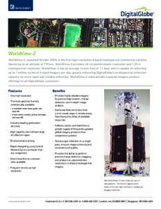
D ATA S H E E T  WorldView-2 WorldView-2, launched October 2009, is the first high-resolution 8-band multispectral commercial satellite. Operating at an altitude of 770 km, WorldView-2 provides 46 cm panchromatic resolut

D ATA S H E E T WorldView-2 WorldView-2, launched October 2009, is the first high-resolution 8-band multispectral commercial satellite. Operating at an altitude of 770 km, WorldView-2 provides 46 cm panchromatic resolut

DocID: 1rcLz - View Document