<--- Back to Details
| First Page | Document Content | |
|---|---|---|
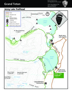 Date: 2010-12-20 17:18:51Teewinot Mountain String Lake Leigh Canyon Mount Woodring Amphitheater Lake Jenny Lake Teton Glacier Holly Lake Canyons of the Teton Range Teton County Wyoming Grand Teton National Park Wyoming |
Add to Reading List |
 | GVSU NEW MUSIC ENSEMBLE • • www.newmusicensemble.com June 1, 2016DocID: 1oOmu - View Document |
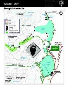 | National Park Service U.S. Department of the Interior Grand Teton Grand Teton National ParkDocID: ZdVs - View Document |
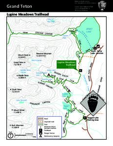 | Grand Teton NP.tpo - TOPO! GPS - Untitled.tpg (Map Level 4 of 5, 1:24,000, 8.DocID: J0fW - View Document |
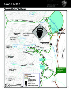 | Grand Teton NP.tpo - TOPO! GPS - Untitled.tpg (Map Level 4 of 5, 1:24,000, 8.DocID: BppL - View Document |
 | Grand Teton NP.tpo - TOPO! GPS - Untitled.tpg (Map Level 4 of 5, 1:24,000, 8.DocID: iNhJ - View Document |
 Grand Teton NP.tpo - TOPO! GPS - Untitled.tpg (Map Level 4 of 5, 1:24,000, 8.