<--- Back to Details
| First Page | Document Content | |
|---|---|---|
 Date: 2013-01-25 06:54:07Hydrology Greater Grand Forks Red River Flood Flood Red River of the North Assiniboine River Devils Lake Portage Diversion Red River Flood in the United States Geography of North Dakota Water Geography of the United States |
Add to Reading List |
 | Rotary Career Symposium SHOW GUIDE DISCOVER YOUR OPTIONS NEW!DocID: 1qzvq - View Document |
 | Crystal Reports ActiveX Designer - Competition ALL MEDALISTS Only by ContestDocID: 1fHl2 - View Document |
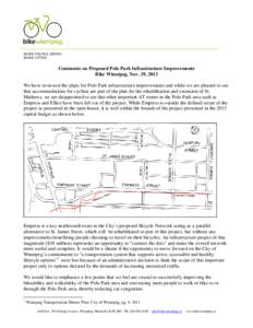
 | We have reviewed the plans for Polo Park infrastructure improvements and are pleased to see that accommodation for cyclists arDocID: 1aAiT - View Document |
 | Fort Peck Health and Resilience Symposium Local Information & FAQs Location: The Fort Peck Reservation is in northeastern Montana, 40 miles west of the North Dakota border and 50 miles south of Canada, with the MissouriDocID: 19F3K - View Document |
 | Top10AssiniboineRiverFloodsSince1880sDocID: 11Cp7 - View Document |
 Appendix 4 Main Text of the Final Report of the International Red River Basin Task Force—April 2000 Appendix 4