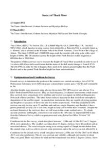
 Geography Surveying Geography of the United Kingdom Cartography Business Geographic data and information Garmin Global Positioning System Triangulation station Leica Camera Easting and northing Ordnance Survey | |  Survey of Thack Moor 22 August 2012 The Team: John Barnard, Graham Jackson and Myrddyn Phillips 03 March 2013 The Team: John Barnard, Graham Jackson, Myrddyn Phillips and Bob Smith (Grough) Survey of Thack Moor 22 August 2012 The Team: John Barnard, Graham Jackson and Myrddyn Phillips 03 March 2013 The Team: John Barnard, Graham Jackson, Myrddyn Phillips and Bob Smith (Grough)
Add to Reading ListSource URL: www.hill-bagging.co.ukDownload Document from Source Website File Size: 371,14 KBShare Document on Facebook
|


 Survey of Thack Moor 22 August 2012 The Team: John Barnard, Graham Jackson and Myrddyn Phillips 03 March 2013 The Team: John Barnard, Graham Jackson, Myrddyn Phillips and Bob Smith (Grough)