<--- Back to Details
First PageDocument Content
Geophysics / Datum / Geodetic system / GeoBase / Geographic coordinate system / Meades Ranch /  Kansas / Latitude / Elevation / Reference ellipsoid / Geodesy / Cartography / Measurement
Date: 2003-02-04 15:43:47
Geophysics
Datum
Geodetic system
GeoBase
Geographic coordinate system
Meades Ranch
Kansas
Latitude
Elevation
Reference ellipsoid
Geodesy
Cartography
Measurement

Federal 3-D Densification Network, Canada, Level 1 Product Specifications Edition[removed]

Add to Reading List

Source URL: geobase.ca

Download Document from Source Website

File Size: 164,82 KB

Share Document on Facebook

Similar Documents

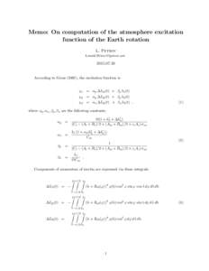
Memo: On computation of the atmosphere excitation function of the Earth rotation L. Petrov

Memo: On computation of the atmosphere excitation function of the Earth rotation L. Petrov

DocID: 1roYU - View Document

Microsoft Word - RT001-SeaZONE-An Introduction to Coordinate Reference Systems.docx

Microsoft Word - RT001-SeaZONE-An Introduction to Coordinate Reference Systems.docx

DocID: 1qXax - View Document

Geodesy / Measurement / Geomatics / Geophysics / Regional Reference Frame Sub-Commission for Europe / Geodetic datum / Geodetic control network / Earth ellipsoid / European Terrestrial Reference System / Global Positioning System / Benchmark / International Terrestrial Reference System

DECISION No. 669, datedON APPROVING OF THE RULES FOR DEFINING, CREATION AND REALIZATION OF THE ALBANIAN GEODETIC REFERENCE FRAME (KRGJSHAS METADATA Based on the Article 100 of the Constitution and on the

DocID: 1qw1w - View Document

The Irish Grid  A Description of the Co-ordinate Reference System used in Ireland Published by the Director, Ordnance Survey of Ireland ã Government of Ireland 1996

The Irish Grid A Description of the Co-ordinate Reference System used in Ireland Published by the Director, Ordnance Survey of Ireland ã Government of Ireland 1996

DocID: 1qlZm - View Document

The Irish Grid  A Description of the Co-ordinate Reference System used in Ireland Published by the Director, Ordnance Survey of Ireland ã Government of Ireland 1996

The Irish Grid A Description of the Co-ordinate Reference System used in Ireland Published by the Director, Ordnance Survey of Ireland ã Government of Ireland 1996

DocID: 1pRRw - View Document