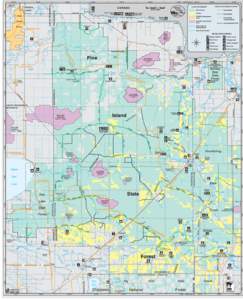
<--- Back to Details
First PageDocument Content
Beltrami County /  Minnesota / Grygla /  Minnesota / Roseau County /  Minnesota / Minnesota State Highway 89 / Geography of Minnesota / Minnesota / Beltrami Island State Forest
Date: 2014-05-29 16:12:40
Beltrami County
Minnesota
Grygla
Minnesota
Roseau County
Minnesota
Minnesota State Highway 89
Geography of Minnesota
Minnesota
Beltrami Island State Forest

Fourtown-Grygla Trail System Beltrami, Marshall & Roseau County Ride 170 miles of trail throughout northwestern Minnesota. Much of this system follows county and township roads, ditch banks and existing trails. County or

Add to Reading List

Source URL: files.dnr.state.mn.us

Download Document from Source Website

File Size: 382,37 KB

Share Document on Facebook

Similar Documents

Beltrami Island State Forest – Watershed Plan NRCS – Regional Conservation Partnership Program Public Scoping Meeting/Open House – July 11, 2016 Roseau River Watershed District Office 108 3rd Avenue SW | Roseau, MN

Beltrami Island State Forest – Watershed Plan NRCS – Regional Conservation Partnership Program Public Scoping Meeting/Open House – July 11, 2016 Roseau River Watershed District Office 108 3rd Avenue SW | Roseau, MN

DocID: 1piGT - View Document

Pine Island State Forest Map

Pine Island State Forest Map

DocID: DJEr - View Document

Pine Island State Forest Map

Pine Island State Forest Map

DocID: Drh0 - View Document

ine Island State Forest is located in Koochiching County in northern Minnesota. Pine Island is the largest of Minnesota’s 57 state forests, encompassing 878,040 acres. More than two-thirds of this area is state-owned.

ine Island State Forest is located in Koochiching County in northern Minnesota. Pine Island is the largest of Minnesota’s 57 state forests, encompassing 878,040 acres. More than two-thirds of this area is state-owned.

DocID: ANvH - View Document

Beltrami Island State Forest

Beltrami Island State Forest

DocID: yBC9 - View Document