<--- Back to Details
First PageDocument Content
Geographic data and information / Geography / Geographic information systems / Data / Computing / National Center for Geographic Information and Analysis / Abbas Rajabifard / Spatial data infrastructure / Geomatics / Werner Kuhn / OMB Circular A-16 / Geographic information science
Date: 2016-03-01 20:18:38
Geographic data and information
Geography
Geographic information systems
Data
Computing
National Center for Geographic Information and Analysis
Abbas Rajabifard
Spatial data infrastructure
Geomatics
Werner Kuhn
OMB Circular A-16
Geographic information science

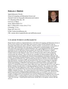
HARLAN J. ONSRUD Spatial Informatics Faculty School of Computing and Information Science and National Center for Geographic Information and Analysis 5711 Boardman Hall, Rm. 340 University of Maine
Add to Reading List

Source URL: umaine.edu

Download Document from Source Website

File Size: 2,28 MB

Share Document on Facebook

Similar Documents

Modeling and Managing the Semantics of Geospatial Data and Services • Werner Kuhn, Martin Raubal, Michael Lutz Institute for Geoinformatics

Modeling and Managing the Semantics of Geospatial Data and Services • Werner Kuhn, Martin Raubal, Michael Lutz Institute for Geoinformatics

DocID: 1ubmt - View Document

Proceedings XIII GEOINFO, November 25-27, 2012, Campos do Jord˜ ao, Brazil. pA Conceptual Analysis of Resolution Auriol Degbelo and Werner Kuhn Institute for Geoinformatics – University of Muenster

Proceedings XIII GEOINFO, November 25-27, 2012, Campos do Jord˜ ao, Brazil. pA Conceptual Analysis of Resolution Auriol Degbelo and Werner Kuhn Institute for Geoinformatics – University of Muenster

DocID: 1rW5K - View Document

Semantic Referencing of Geosensor Data and Volunteered Geographic Information Simon Scheider, Carsten Keßler, Jens Ortmann, Anusuriya Devaraju, Johannes Trame, Tomi Kauppinen, Werner Kuhn Institute for Geoinformatics, U

Semantic Referencing of Geosensor Data and Volunteered Geographic Information Simon Scheider, Carsten Keßler, Jens Ortmann, Anusuriya Devaraju, Johannes Trame, Tomi Kauppinen, Werner Kuhn Institute for Geoinformatics, U

DocID: 1r4LZ - View Document

Are Displays Maps or Views? WERNER KUHN National Center for Geographic Information and Analysis and Department of Surveying Engineering University of Maine

Are Displays Maps or Views? WERNER KUHN National Center for Geographic Information and Analysis and Department of Surveying Engineering University of Maine

DocID: 1r3Kg - View Document

Linked Data and Time – Modeling Researcher Life Lines by Events Johannes Trame, Carsten Keßler, and Werner Kuhn Institute for Geoinformatics, University of M¨ unster, Germany {johannes.trame,carsten.kessler,kuhn}@uni

Linked Data and Time – Modeling Researcher Life Lines by Events Johannes Trame, Carsten Keßler, and Werner Kuhn Institute for Geoinformatics, University of M¨ unster, Germany {johannes.trame,carsten.kessler,kuhn}@uni

DocID: 1qMlf - View Document