<--- Back to Details
| First Page | Document Content | |
|---|---|---|
 Date: 2010-05-11 18:07:14Real property law Oregon Coast Tillamook County Oregon Oregon Route 6 Zoning Oregon Route 131 Nehalem River Geography of the United States Oregon West Coast of the United States Real estate |
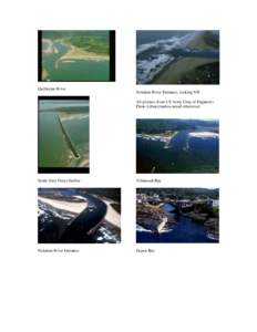 | Quillayute River Nehalem River Entrance, looking NW All pictures from US Army Corp of Engineers Photo Library(unless noted otherwise)DocID: 1elUG - View Document |
 | LOMR SUBMITTAL LOWER NORTH FORK NEHALEM RIVER TILLAMOOK COUNTY, OREGON Prepared for: TILLAMOOK COUNTYDocID: 1ajOc - View Document |
 | LOMR SUBMITTAL LOWER NEHALEM RIVER TILLAMOOK COUNTY, OREGON Prepared for: TILLAMOOK COUNTYDocID: 1abTA - View Document |
 | PDF DocumentDocID: 1aaEX - View Document |
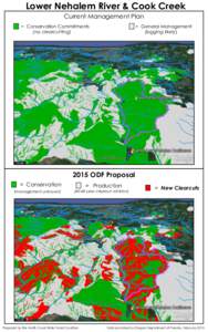 | Lower Nehalem River & Cook Creek Current Management Plan = Conservation Commitments (no clearcutting) = General ManagementDocID: 1aaaW - View Document |
