<--- Back to Details
First PageDocument Content
European Space Agency / Remote sensing / AATSR / Earth sciences / Snow / Envisat / Moderate-Resolution Imaging Spectroradiometer / Cloud computing / Cloud / Atmospheric sciences / Spaceflight / Earth
Date: 2014-02-27 13:27:01
European Space Agency
Remote sensing
AATSR
Earth sciences
Snow
Envisat
Moderate-Resolution Imaging Spectroradiometer
Cloud computing
Cloud
Atmospheric sciences
Spaceflight
Earth

Northern Hemisphere Fractional Snow mapping with VIIRS: First experiments in ESA DUE GlobSnow-2 Sari Metsämäki, Kari Luojus, Mwaba Kangwa-Hiltunen, Jouni Pulliainen, Andreas Wiesmann Finnish Environment Institute, Finl
Add to Reading List

Source URL: www.earsel.org

Download Document from Source Website

File Size: 51,21 KB

Share Document on Facebook

Similar Documents

СПУТНИКОВОЕ МИКРОВОЛНОВОЕ ПАССИВНОЕ И АКТИВНОЕ ДИСТАНЦИОННОЕ ЗОНДИРОВАНИЕ: От КОСМОСА-243 И КосмосА-1500 до Envisat, ALOS и GCOM-W1

DocID: 1vjCM - View Document

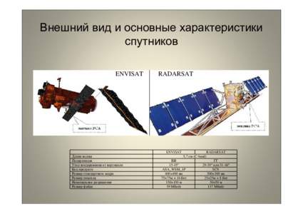
Внешний вид и основные характеристики спутников ENVISAT RADARSAT

Внешний вид и основные характеристики спутников ENVISAT RADARSAT

DocID: 1usxT - View Document

Satellite Products  Satellite Products A large number of Earth-orbiting satellites are constantly and globally monitoring the state of the atmosphere, ocean and ice sheets. StormGeo acquires raw data from a wide range of

Satellite Products Satellite Products A large number of Earth-orbiting satellites are constantly and globally monitoring the state of the atmosphere, ocean and ice sheets. StormGeo acquires raw data from a wide range of

DocID: 1ri5H - View Document

20th Anniversary of the Montreal Protocol http://www.20yearsmontrealprotocol.org Symposium “Ozone Depletion: from its discovery to Envisat and Aura” Athens, Greece September 23-26, 2007

20th Anniversary of the Montreal Protocol http://www.20yearsmontrealprotocol.org Symposium “Ozone Depletion: from its discovery to Envisat and Aura” Athens, Greece September 23-26, 2007

DocID: 1r5YJ - View Document

Local-Scale Geohazard Risk Assessment Using SAR Interferometric Techniques: a Case Study of Larissa National Airport Central Greece F. Fakhri 1  Department of Geography and Geology, University of Turku, F1Turku, F

Local-Scale Geohazard Risk Assessment Using SAR Interferometric Techniques: a Case Study of Larissa National Airport Central Greece F. Fakhri 1 Department of Geography and Geology, University of Turku, F1Turku, F

DocID: 1qVkH - View Document