<--- Back to Details
First PageDocument Content
Lake Rossignol / Rossignol / Geography of Canada / Shelburne River / The Tent Dwellers / Southwest Nova Biosphere Reserve / Mersey Tobeatic Research Institute / Region of Queens Municipality / Mersey River / Nova Scotia / Queens County /  Nova Scotia / Provinces and territories of Canada
Date: 2009-03-12 08:00:00
Lake Rossignol
Rossignol
Geography of Canada
Shelburne River
The Tent Dwellers
Southwest Nova Biosphere Reserve
Mersey Tobeatic Research Institute
Region of Queens Municipality
Mersey River
Nova Scotia
Queens County
Nova Scotia
Provinces and territories of Canada

Sent March 10, 2009 OLD LAKE ROSSIGNOL

Add to Reading List

Source URL: www.merseytobeatic.ca

Download Document from Source Website

File Size: 336,99 KB

Share Document on Facebook

Similar Documents

Mahican-Mohawk Trail Shelburne Falls Extension of the New Haven & Northampton RR. Later New Haven RR. Built inAbandonedEndpoints: Hoosac Road in Deerfield to the South River and Bardwell Ferry Bridge in She

Mahican-Mohawk Trail Shelburne Falls Extension of the New Haven & Northampton RR. Later New Haven RR. Built inAbandonedEndpoints: Hoosac Road in Deerfield to the South River and Bardwell Ferry Bridge in She

DocID: 1m6iK - View Document

Department of Historic Resources

Department of Historic Resources

DocID: R9KE - View Document

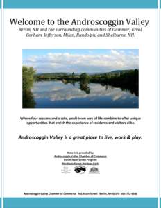
Welcome to the Androscoggin Valley Berlin, NH and the surrounding communities of Dummer, Errol, Gorham, Jefferson, Milan, Randolph, and Shelburne, NH. Where four seasons and a safe, small-town way of life combine to offe

Welcome to the Androscoggin Valley Berlin, NH and the surrounding communities of Dummer, Errol, Gorham, Jefferson, Milan, Randolph, and Shelburne, NH. Where four seasons and a safe, small-town way of life combine to offe

DocID: Koe4 - View Document

Shelburne Bay Watershed Updated Assessment Information June 2013 There are four named streams and their tributaries that flow into Shelburne Bay. They include the LaPlatte River and its tributaries; Munroe Brook and its

Shelburne Bay Watershed Updated Assessment Information June 2013 There are four named streams and their tributaries that flow into Shelburne Bay. They include the LaPlatte River and its tributaries; Munroe Brook and its

DocID: HiW7 - View Document

Coastal Zone Inland Zone Connecticut River Zone Northern / Inland Zone boundary Wildlife Management Unit boundary

Coastal Zone Inland Zone Connecticut River Zone Northern / Inland Zone boundary Wildlife Management Unit boundary

DocID: D5A9 - View Document