<--- Back to Details
First PageDocument Content
Geography / Data / Geographic data and information / Open Geospatial Consortium / Geographic information systems / GeoSciML / ISO/TC 211 / OneGeology / Geological survey / International Union of Geological Sciences / GeoSUR / Web Map Service
Date: 2013-05-16 04:32:08
Geography
Data
Geographic data and information
Open Geospatial Consortium
Geographic information systems
GeoSciML
ISO/TC 211
OneGeology
Geological survey
International Union of Geological Sciences
GeoSUR
Web Map Service

Microsoft Word - CGI-ANNUAL_REPORT_20111
Add to Reading List

Source URL: cgi-iugs.org

Download Document from Source Website

File Size: 174,63 KB

Share Document on Facebook

Similar Documents

Minutes OneGeology Technical Implementation Group 2pm-6pm CET Tuesday 23rd May 2017 Venue Offices of Austrian Geological Survey (GBA) Vienna

Minutes OneGeology Technical Implementation Group 2pm-6pm CET Tuesday 23rd May 2017 Venue Offices of Austrian Geological Survey (GBA) Vienna

DocID: 1vsfz - View Document

DMTDIGITAL MAPPING TECHNIQUES 2014 The following was presented at DMT‘14 (June 1-4, Delaware Geological Survey, Newark, DE)

DMTDIGITAL MAPPING TECHNIQUES 2014 The following was presented at DMT‘14 (June 1-4, Delaware Geological Survey, Newark, DE)

DocID: 1vrrq - View Document

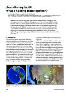
Accretionary lapilli: what’s holding them together? Paul M. Adams,1 David K. Lynch2 and David C. Buesch3 Thule Scientific, P.O. Box 953, Topanga, CAUSA, ; 2U.S. Geological Survey, 525 South

Accretionary lapilli: what’s holding them together? Paul M. Adams,1 David K. Lynch2 and David C. Buesch3 Thule Scientific, P.O. Box 953, Topanga, CAUSA, ; 2U.S. Geological Survey, 525 South

DocID: 1vr9t - View Document

Editorial Board Croatian Geological Survey Sachsova 2, P.O.Box 268 HRZagreb, Croatia Editors: Mladen Juračić, University of Zagreb, Croatia and Lidija Galović, Croatian Geological Survey (e-mail: editor@geologi

Editorial Board Croatian Geological Survey Sachsova 2, P.O.Box 268 HRZagreb, Croatia Editors: Mladen Juračić, University of Zagreb, Croatia and Lidija Galović, Croatian Geological Survey (e-mail: editor@geologi

DocID: 1vqZz - View Document

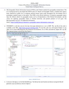
GNIS to RDF Center of Excellence for Geographic Information Systems United States Geological Survey   The Geographic Names Information System (GNIS) is the Federal standard for geographic nomenclature. The

GNIS to RDF Center of Excellence for Geographic Information Systems United States Geological Survey  The Geographic Names Information System (GNIS) is the Federal standard for geographic nomenclature. The

DocID: 1vqBQ - View Document