<--- Back to Details
First PageDocument Content
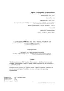
Open Geospatial Consortium / ISO/TC 211 / GIS file formats / Geographic information systems / Standards organizations / Geography Markup Language / Well-known text / Simple Features / ISO/IEC JTC 1 / ISO / Coverage data / ISO/TC 211 Geographic information/Geomatics
Date: 2015-08-27 09:24:46
Open Geospatial Consortium
ISO/TC 211
GIS file formats
Geographic information systems
Standards organizations
Geography Markup Language
Well-known text
Simple Features
ISO/IEC JTC 1
ISO
Coverage data
ISO/TC 211 Geographic information/Geomatics

Microsoft Word - A_Conceptual_Model_and_Text-based_Notation_for_Temporal_Geometry_2015doc
Add to Reading List

Source URL: external.opengeospatial.org

Download Document from Source Website

File Size: 222,31 KB

Share Document on Facebook

Similar Documents

SUOMEN GEODEETTISEN LAITOKSEN JULKAISUJA VERÖFFENTLICHUNGEN DES FINNISCHEN GEODÄTISCHEN INSTITUTES PUBLICATIONS OF THE FINNISH GEODETIC INSTITUTE ================================= N:o 138 ==============================

SUOMEN GEODEETTISEN LAITOKSEN JULKAISUJA VERÖFFENTLICHUNGEN DES FINNISCHEN GEODÄTISCHEN INSTITUTES PUBLICATIONS OF THE FINNISH GEODETIC INSTITUTE ================================= N:o 138 ==============================

DocID: 1rqki - View Document

OGC WaterML 2.0 Specification

OGC WaterML 2.0 Specification

DocID: 1riZA - View Document

Geo-Wiki: An online platform for improving global land cover

Geo-Wiki: An online platform for improving global land cover

DocID: 1riV0 - View Document

Computing / Geography / Business / Air traffic control / Alphabet Inc. / Keyhole Markup Language / Google / Open Geospatial Consortium / Google Earth / Point of interest / Airspace / DAFIF

2013 Airspace Coordinator “Tool Kit” (Where is the Interagency Airspace Coordination Guide located? www.airspacecoordination.net or www.airspacecoordination.org or www.airspacecoordination.com FAA Progra

DocID: 1rf34 - View Document

Tellus Border Data delivery programme: Delivering and managing Geophysical and Geochemical datasets Shane Carey, Geological Survey of Ireland GIS and Data Manager

Tellus Border Data delivery programme: Delivering and managing Geophysical and Geochemical datasets Shane Carey, Geological Survey of Ireland GIS and Data Manager

DocID: 1rdXb - View Document