<--- Back to Details
| First Page | Document Content | |
|---|---|---|
 Date: 2014-05-27 15:05:56Taunton Massachusetts Geography of the United States Taunton River Watershed Taunton River Current sea level rise Narragansett Bay Coast Geography of Massachusetts Bristol County Massachusetts Greater Taunton Area |
Add to Reading List |
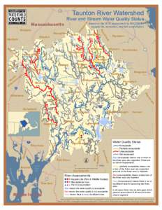
 | Taunton River Watershed 128 River and Stream Water Quality StatusDocID: 1vpBx - View Document |
 | Taunton River Watershed: River Water Quality 100% 80% 48%DocID: 1uJCk - View Document |
 | Taunton River Watershed 128 River and Stream Water Quality Status olDocID: 1u0jb - View Document |
 | Microsoft Word - satucket.docDocID: 1rb1v - View Document |
 | Microsoft Word - section12docxDocID: 1pAna - View Document |
 Salt marsh on the Taunton River Somerset Waterfront Park during a storm surge Dighton with four feet of