<--- Back to Details
First PageDocument Content
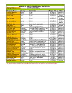
Quemahoning Reservoir / Presque Isle Bay / Presque Isle State Park / Wallenpaupack / Quemahoning Township /  Somerset County /  Pennsylvania / Curwensville Lake / Keystone Lake / Geography of Pennsylvania / Pennsylvania / Geography of the United States
Date: 2014-05-29 14:34:53
Quemahoning Reservoir
Presque Isle Bay
Presque Isle State Park
Wallenpaupack
Quemahoning Township
Somerset County
Pennsylvania
Curwensville Lake
Keystone Lake
Geography of Pennsylvania
Pennsylvania
Geography of the United States

Priority Waters DIVISION OF HABITAT MANAGEMENT, LAKE SECTION 2014 FIELD SCHEDULE Waterway Name
Add to Reading List

Source URL: fishandboat.com

Download Document from Source Website

File Size: 115,29 KB

Share Document on Facebook

Similar Documents

SolarMaps  Carolyn S. Fish, Patrick Stephens, Kirby E. Calvert The Pennsylvania State University Department of Geography

SolarMaps Carolyn S. Fish, Patrick Stephens, Kirby E. Calvert The Pennsylvania State University Department of Geography

DocID: 1sM7V - View Document

Cartographic Challenges in Animated Mapping Carolyn S. Fish Department of Geography The Pennsylvania State University University Park, PA, USA

Cartographic Challenges in Animated Mapping Carolyn S. Fish Department of Geography The Pennsylvania State University University Park, PA, USA

DocID: 1sKAC - View Document

Department of Geography and the Environment Villanova University In 2016, Villanova purchased a SPOT-6 satellite image with the Pennsylvania View (PA View) grant funding. The goal was to use the imagery to demonstrate fo

Department of Geography and the Environment Villanova University In 2016, Villanova purchased a SPOT-6 satellite image with the Pennsylvania View (PA View) grant funding. The goal was to use the imagery to demonstrate fo

DocID: 1sjYn - View Document

The use of remotely sensed imagery and GIS analysis for the automated detection of water infiltration in residential structures Robert E. Roth |  The Pennsylvania State University

The use of remotely sensed imagery and GIS analysis for the automated detection of water infiltration in residential structures Robert E. Roth | The Pennsylvania State University

DocID: 1rCx8 - View Document

Paulo Raposo MS, PhD Candidate (ABD) Department of Geography, Penn State , , Phone302 Walker Building, The Pennsylvania State University, University Park, PA,

Paulo Raposo MS, PhD Candidate (ABD) Department of Geography, Penn State , , Phone302 Walker Building, The Pennsylvania State University, University Park, PA,

DocID: 1rxYG - View Document