<--- Back to Details
First PageDocument Content
Artificial intelligence / Kinect / Stereo cameras / Structured light / Ultrasonic sensor / 3D reconstruction / Rendering / Depth map / Image scanner / 3D computer graphics / Human–computer interaction / Imaging
Date: 2015-04-26 10:32:34
Artificial intelligence
Kinect
Stereo cameras
Structured light
Ultrasonic sensor
3D reconstruction
Rendering
Depth map
Image scanner
3D computer graphics
Human–computer interaction
Imaging

3D Reconstruction in the Presence of Glasses by Acoustic and Stereo Fusion http://vis.uky.edu/˜gravity/Research/audiofusion Mao Ye Univ. of Kentucky Lexington, USA
Add to Reading List

Source URL: gamma.cs.unc.edu

Download Document from Source Website

File Size: 2,87 MB

Share Document on Facebook

Similar Documents

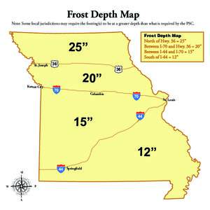
Frost Depth Map Note: Some local jurisdictions may require the footing(s) to be at a greater depth than what is required by the PSC. Frost Depth Map North of Hwy. 36 = 25” Between I-70 and Hwy. 36 = 20”

Frost Depth Map Note: Some local jurisdictions may require the footing(s) to be at a greater depth than what is required by the PSC. Frost Depth Map North of Hwy. 36 = 25” Between I-70 and Hwy. 36 = 20”

DocID: 1tR0U - View Document

Efficient Grasping from RGBD Images: Learning using a new Rectangle Representation Yun Jiang, Stephen Moseson, and Ashutosh Saxena Abstract— Given an image and an aligned depth map of an object, our goal is to estimate

Efficient Grasping from RGBD Images: Learning using a new Rectangle Representation Yun Jiang, Stephen Moseson, and Ashutosh Saxena Abstract— Given an image and an aligned depth map of an object, our goal is to estimate

DocID: 1tIC7 - View Document

Hybrid Kinect Depth Map Refinement For Transparent Objects Gorkem Saygili Laurens van der Maaten

Hybrid Kinect Depth Map Refinement For Transparent Objects Gorkem Saygili Laurens van der Maaten

DocID: 1rit7 - View Document

An interactive map provides easy navigation to NRCS and other network monitoring stations. The map displays current and historical conditions for SWE, snow depth, precipitation, streamflow, and reservoir storage.

An interactive map provides easy navigation to NRCS and other network monitoring stations. The map displays current and historical conditions for SWE, snow depth, precipitation, streamflow, and reservoir storage.

DocID: 1qaHk - View Document

Depth Map and Normal Direction Fusion Depth Map Goal: Include surface normal direction likelihood

Depth Map and Normal Direction Fusion Depth Map Goal: Include surface normal direction likelihood

DocID: 1p8jI - View Document