<--- Back to Details
First PageDocument Content
Geology of Minnesota / Whetstone River / Minnesota River / Traverse Gap / Mississippi River / Yellow Bank River / Lake Traverse / Minnesota / Watershed district / Geography of Minnesota / Geography of the United States / Geography of South Dakota
Date: 2013-03-12 09:33:53
Geology of Minnesota
Whetstone River
Minnesota River
Traverse Gap
Mississippi River
Yellow Bank River
Lake Traverse
Minnesota
Watershed district
Geography of Minnesota
Geography of the United States
Geography of South Dakota

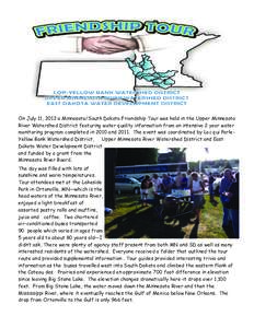
UPPER MINNESOTA RIVER WATERSHED FIVE YEAR STRATEGIC PLAN In Cooperation With: East Dakota Water Development District South Dakota Conservation Districts
Add to Reading List

Source URL: denr.sd.gov

Download Document from Source Website

File Size: 3,58 MB

Share Document on Facebook

Similar Documents

LAC QUI PARLE-YELLOW BANK WATERSHED LOW INTEREST LOAN APPLICATION FOR INDIVIDUAL SEWAGE TREATMENT SYSTEMS Please Print Clearly ___________________________________________ Telephone_________________________ Name of Applic

LAC QUI PARLE-YELLOW BANK WATERSHED LOW INTEREST LOAN APPLICATION FOR INDIVIDUAL SEWAGE TREATMENT SYSTEMS Please Print Clearly ___________________________________________ Telephone_________________________ Name of Applic

DocID: 1qP3c - View Document

Lead Story Headline  Microsoft On July 11, 2012 a Minnesota/South Dakota Friendship Tour was held in the Upper Minnesota River Watershed District featuring water quality information from an intensive 2 year water

Lead Story Headline Microsoft On July 11, 2012 a Minnesota/South Dakota Friendship Tour was held in the Upper Minnesota River Watershed District featuring water quality information from an intensive 2 year water

DocID: 1qdx0 - View Document

UPPER MINNESOTA RIVER WATERSHED FIVE YEAR STRATEGIC PLAN In Cooperation With: East Dakota Water Development District South Dakota Conservation Districts

UPPER MINNESOTA RIVER WATERSHED FIVE YEAR STRATEGIC PLAN In Cooperation With: East Dakota Water Development District South Dakota Conservation Districts

DocID: MbTl - View Document

OKALOOSA COUNTY COMMISSIONER DISTRICTS[removed]BOUNDARY OF COMMISSIONER DISTRICT 1 BEGINNING AT THE INTERSECTION OF THE EAST BANK OF THE YELLOW RIVER AND THE FLORIDA-ALABAMA STATE LINE SAID POINT BEING POINT OF BEGINN

OKALOOSA COUNTY COMMISSIONER DISTRICTS[removed]BOUNDARY OF COMMISSIONER DISTRICT 1 BEGINNING AT THE INTERSECTION OF THE EAST BANK OF THE YELLOW RIVER AND THE FLORIDA-ALABAMA STATE LINE SAID POINT BEING POINT OF BEGINN

DocID: A2fL - View Document

Birds of Great River Bluffs State Park  ❏ Northern Rough-winged Swallow ❏ Bank Swallow ❏ Cliff Swallow ❏ Barn Swallow

Birds of Great River Bluffs State Park ❏ Northern Rough-winged Swallow ❏ Bank Swallow ❏ Cliff Swallow ❏ Barn Swallow

DocID: zmDF - View Document