<--- Back to Details
| First Page | Document Content | |
|---|---|---|
 Date: 2015-03-23 09:47:30Mole Valley Dorking Westhumble Molesey Raynes Park Sutton and Mole Valley Lines Surrey Counties of England Geography of England |
Add to Reading List |
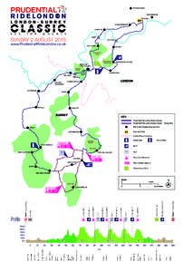
 | RideLondon_ClassicMap_2015DocID: 12kAu - View Document |
 | Thames Down Link Follow all, or part, of this fifteen mile walking route linking the Thames Path National Trail in Kingston to the North Downs Way National Trail near Westhumble; hence the name, Thames Down Link. ExploreDocID: 975c - View Document |
 | PDF DocumentDocID: zPy - View Document |
 RideLondon_ClassicMap_2015